Four years ago, I was invited to ride an off road century, from Prescott to Flagstaff. It would be my longest ride at the time. Some friends and I set off before dawn and made our way along an old railroad bed, ranch doubletrack, volcanic singletrack, powerline, mining, and logging roads. 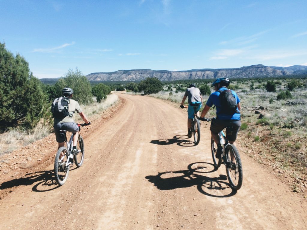 When I got to Flag, I could hardly walk. My knee was toast and I could barely make the one mile commute to and from work for more than a week after. It was the hardest single day I had ever ridden, but I was in love with the idea of pushing even farther. I just wanted to see how far I could go, what could the limit be?
Fast forward to May 17th, 2019. This weekend is the innaugural Pinyons and Pines Bikepacking Race, hosted by Dana Ernst. The 280 mile route created a figure 8, centered in Flagstaff. Since I am only a few weeks out from beginning the 2019 Tour Divide, I thougt riding the bike to Flag would be a good shakedown of my gear and test to see how well I can recover from a century before riding in a bikepacking race. I loaded up the majority of my Tour Divide kit, with the exception of using my second string rain gear. I am saving the good stuff for the Divide. Friday morning, I got Caiden on the bus, ran the dog, dropped off a laptop and some cables to a couple clients, and I was on my way to Flag.
I took the same route I had taken on my first century. This time will likely be my last using this route. Over the years, more gates are locked, and more fences have been strung up through the once wide open, rolling landscape. Once on Forest Service land, there are no more gates, just cattle guards. The sun was warm as I made the descent into the Verde River at Perkinsville. I had plenty of water, so I skipped treating water from the Verde and started the climb towards the Great Western Trail. The GWT is a fairly rugged route that was supposed to connect from Canada all the way to Mexico, but I don’t know that the route was ever truly completed. 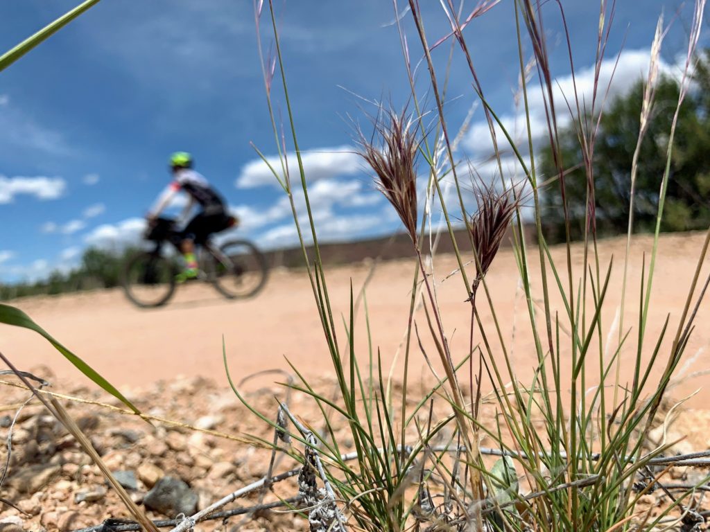
From Perkinsville Rd. up to the plateau south of Williams, I took my time to walk up the loosest sandy sections. One section resembles a yellow sandstone staircase tipped over. No reason to blow up my heart rate just getting to the race. As I got closer to Flagstaff, the temperature slowly dropped, but the ruggedness of the roads hardly let up. For the first time, I saw wild horses roaming a pine forest. 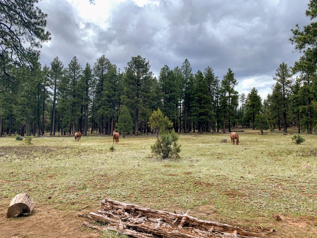 I took the dirt road detour around the Sycamore Canyon Rim Trail to try to save a little time, this is where I happened to run in to one of my friends from Prescott, Ryan Winkelman was off-roading his way to the Overland Expo in Flag. Of all the routes we could have taken, we somehow both picked the same road and were on it at the same time. After a few more logging operations, and a dry lakebed, I had made it to Chick-fil-a for some carbs and protein to recover. While my riding time wasn’t much faster than my first century, I was in much better shape to ride the next day. After finishing my meal, I rode over to Dana’s house to catch some sleep.
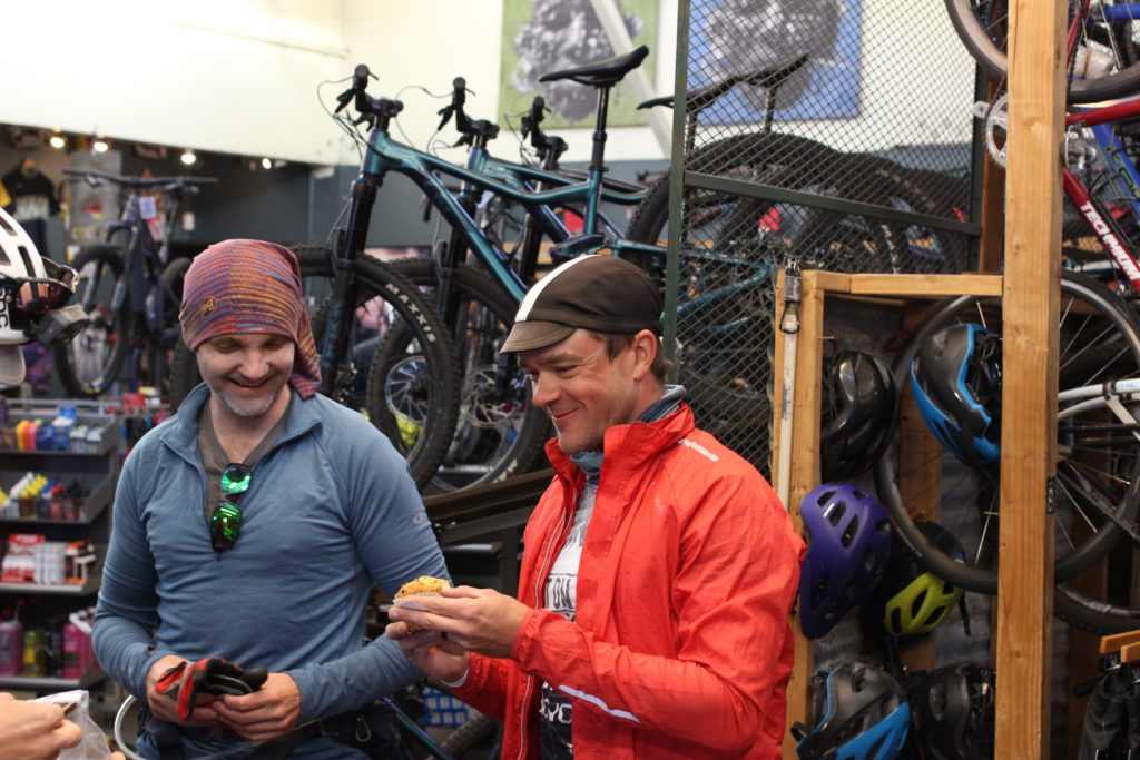
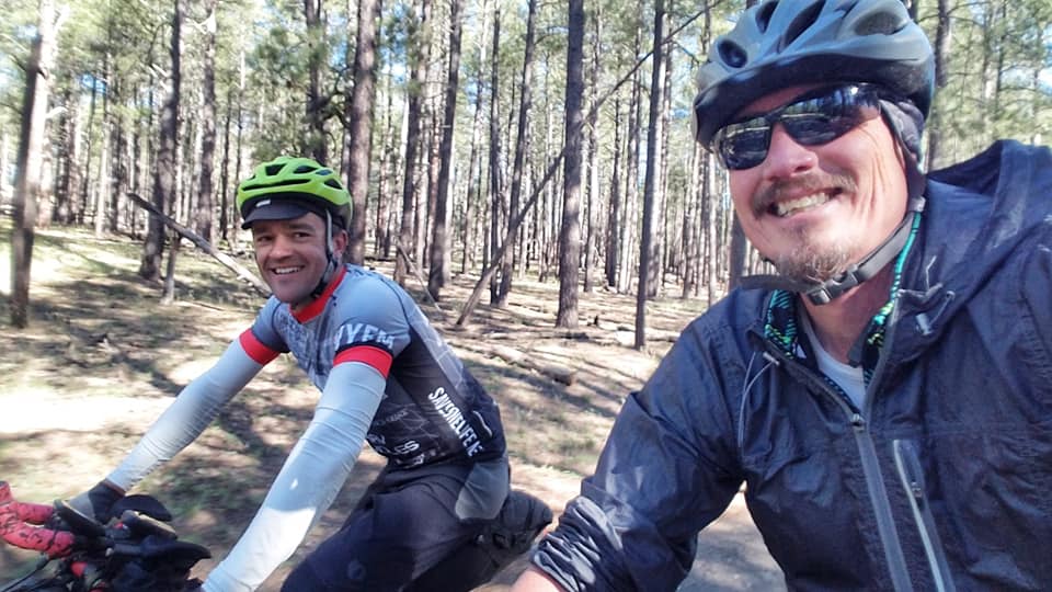
When I arrived at Dana’s, Billy was still sorting out and packing his food away. We talked a little before rolling out the mats and trying to get some rest. We were up at 4am, drinking coffee, layering up, and trying to down some breakfast. I rolled out early to grab some food at Fry’s. I snagged some muffins and honeybuns to get me through to Sedona. When I got to Flag Bike Revolution, the place was swarming with loaded bikes. I shoved muffins in my mouth inbetween greeting friends and washed it all down with a can of coffee.
Around 6am, nearly forty of us rolled out after a breifing by ride master, Dana. We stayed together in a neutral start as we moved our way over to the Woody Mountain Trails. Even though I had to stop to pee several times, and gave up several positions, I was happy to be hydrated after riding the day before. I missed a couple turns in the winding singletrack so I took off my sunglasses for a while in order to see the screen better. From that point on, I was constantly watching the track on my Garmin. Eventually I rolled up behind Billy and worked my way towards catching him.
We pedaled together briefly until I started pulling away on a climb, I wouldn’t see Billy again. The dirt roads to Casner Canyon aren’t traveled by many since the road is open to Jeeps by permit only. The views in this stretch of the course are unparallelled, and very few people ever make the trek to see them. The road splits the Sycamore Canyon Wilderness and the Red Rock Wilderness. Signs on both sides of the road telling you to stay on course and no wheeled access to either area. 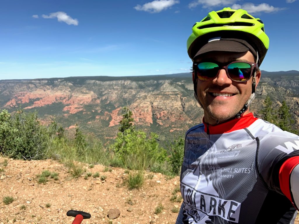 After we passed the gate, the road turns to rocks and begins several steep ups and downs. I had no reason to risk a crash or blow up my heart rate on the climbs, so I just kept moving forward, no matter how slow that was. The last time I was on that road, I was on my drop-bar bike, on 40c tires, and a full on flat in the rear. The road makes one final plunge, something like 1800′ in two miles, on loose rocky switchbacks. I half walked, half rode, again, I’m not trying to get injured this close to the Divide. Once we made the crazy steep descent to the dirt roads between Cottonwood and Sedona, I could pick up my pace and catch up a little. That only lasted thirteen miles until we hit the Aerie Trail. It wasn’t too bad, but as the miles rolled on, we continued taking some rougher and rougher trails. I was taking it super easy through Sedona, since last year, a crash there was what knocked me out of riding the Tour Divide. No chances. The singletrack miles were ticking by and I was excited to eat some real food in town.
When I pulled up to Burger King, a Whopper sounded fantastic. I ordered a full large size meal, and an ice cream sundae for dessert. I sat down to eat with Dylan Turner and as we were both shoveling food into our mouths, another racer came in, looked at our trays of food, and was convinced it was all going to come back up on the 6-mile climb up Schnebly Hill Rd. Dylan and I joked that competition eating was part of training for bikepacking. I filled a couple bottles with cold water and rolled on. The climb up Schnebly is a steady 1800′ climb with big rocks embeded all over the road. We all tried to take the smoothest path, but were constantly interupted by Jeeps and side-by-sides zooming by. I passed one group of tourists almost a dozen times before we got to the overlook. After the overlook, traffic died down a little as we headed towards I-17. The climbing continued, but we got a few breaks, and it wasn’t nearly as steep. Just before the highway, there is an ADOT yard with a pavillion that has a water spigot. I regrouped with a guy riding his singlespeed there. We rolled away from the spigot together, but since he was on a singlespeed, and the roads were pretty fast, I was able to pull away without too much effort. This was about the point where I was going to take a photo, but then realized my phone had updated and was now requiring an activation server to even let me take a picture. Stupid phones. No service, no activation, I was stuck with no photos for a while. We rode the AZT for a few miles, much of which I had ridden in the Coconino 250 loop, it was just backwards this time. The route cut off towards Lake Mary and some, new to me, singletrack that led to more AZT and eventually to Flagstaff’s Urban Trail System. Ben Hanus came up from behind me so fast, I could’t beleive it. He had made a wrong turn, taking the second loop in the wrong direction, before finishing the first loop. I had split my GPX track into two separate loops to eliminate any confusion.
I caught back up to Ben at the Conoco in Flagstaff. We talked about warm food options while we packed our supplies, and he was off. I saw him stopped at a pizza place, so I looked for something faster. I ordered two Pitas from Pita Pit, and ate them as fast as I could. The temps kept dropping, and we were going to be climbing up to 9300′ so I layered up before rolling out of town. Logging operations rerouted us off the normal way up the mountain and on to some side trails. As I was winding through the singletrack, I could see another set of lights zig-zagging around in front of me. I got pretty close to Ben, but after 140 miles, I decided I would get some quick rest. I let Ben pull away and I found a nice bed of pine needles to lay my bivy on. I set an alarm for less than two hours of sleep, and dozed off after eating some cookies.
The alarm went off at 3:30am. I packed away camp, made sure I left no trace, and continued the climb towards Aspen Corner. I was in no mood to be negotiating the trail that early, so I walked a lot, and ate at the same time. When I got to the top, I was grateful for where I rested earlier as the temps seemed to drop even more on the far side of the mountain. I checked the thermometer, it read 30 degrees. The wind was also really starting to pick up too. I thought it was just because I was at elevation.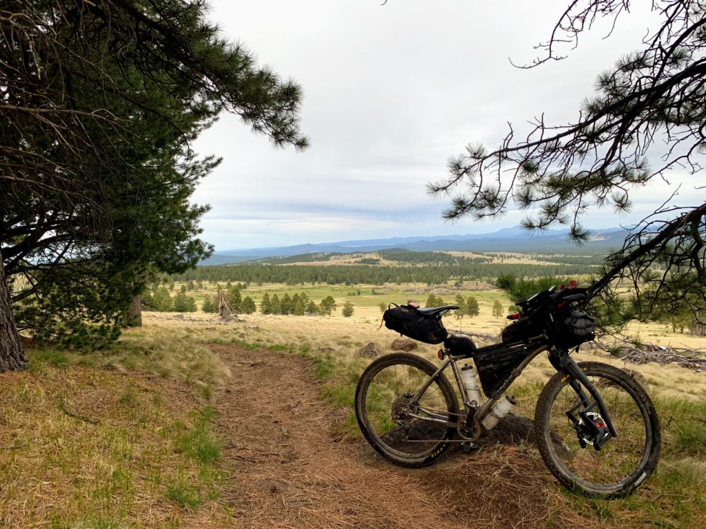 I rode the singletrack down to FR418 where we would begin riding mostly dirt roads for the remainder of the day. There was a quartering headwind that I figured would have its good and bad side on the loop. The skies were grey, and the wind was getting stronger, but I could see I was heading towards sun and partly cloudy skies, so I was optomistic I would stay ahead of the weather in the muddiest sections. I didn’t realize that behind me, some riders were already getting snowed on. As the miles ticked by, I just had to make sure I kept eating. I was carrying plenty of Tailwind drink mix, some king size candy bars, a couple giant muffins, and some cracker sandwiches. As far as water goes, I was allowed to take up to 3 litres from the AZT water cache. The race organizer loaded it up with many gallons ahead of time. I had ridden this section of the course before, on my way back from the Grand Canyon, and I knew the cache wasn’t too far off. The crosswind was now so intense, my front wheel was sliding across the road. My path was a zig-zag on the dirt road. When I arrived at the water cache, I filled my bottles and drank a bottle full. The road turned so I had a full tailwind, and I blasted off like a rocket. I was travelling at 30 mph without pedaling and in no time, I was paying for it. Riding into the wind was bad enough, but I could see a climb coming up with dirt blasting off of it in the 30-40 mph gusts. I glanced at my Garmin and could see that climb was on route. When I got to the base, I was already in my easiest gear, hardly moving. I walked up the minor grade as if it were almost straight up, pushing my bike straight in front of me. At the top, I started to get hit with rain drops, but the rain clouds were probably 20 miles away.
As I continued on, the rain closed in slowly and eventually started to come down hard enough, I needed my rain gear on. If the weather was warmer, the rain would have been refreshing, with the wind, it was just cold. I stopped under a bush for some shelter, so I could eat some food. Even though I was getting wet, the dirt on the road wasn’t being affected too bad. This part of the route was passing through the dead volcanoes on the north side of Flagstaff. The scenery was beautiful, but with the impending weather, and the posibility of things getting much worse, I constantly focused on forward motion. When I got to the soft grey cinder road climb, the main goal was just to keep moving. The road was too soft to ride with one hand, I had to eat while walking the bike to get in the calories and keep my momentum. At least the sun was back out for this bit, and the wind had even died down. After crossing the highway, the road carried on to the Sunset Crater National Monument, the weather also started to rear it’s ugly head again. I stopped at the visitor center to try to pay my way through. When I asked the shop worker about paying, he glanced at his bare wrist and said, “You’re just in time… to not have to pay. Anyone braving the weather today deserves something for it.” He also told me I was an hour and a half behind the last guy, Ben, and 3 and ahalf behind the first two, Dana and Chris. Woohoo, $15 saved, and I was in fourth place, awesome!
The rain started to sprinkle again. The base of the final big climb was at 7000′ and made its way up to 9300′ in 7 miles. The rain started to mix with some ice crystals. I had made this climb up the gravel to Lockett Meadow before, I knew it wasn’t that bad. As I pedaled up, the rain continued its transition to freezing rain, then snow. Lockett Meadow was beautiful in the snow, but I was so focused on moving forward, and keeping warm, I couldn’t be bothered to take off the gloves for a photo. I passed a camp with a few Overlanders and their trucks, looking at me in the weather, they knew I was crazy. I found the trailhead, and started walking up the trail. There was no point in riding the Inner Basin Trail, it’s steep, and covered with rocks and roots. The snow was deep enough now that the trail was covered and finding the route became diffficult. I am normally disgusted by the people who feel the need to carve their initials on the Aspen trees, but today the graffiti was the only trail marker I had to follow. Any time I needed to find my way, I’d just look for the hearts and initials on the trees. After lifting over dozens of dead trees and navigating the snowy trail, I had finally made it to Waterline Road. The wind was whipping at the top and dumping tree-fulls of snow on me. I had to quickly pull off my rain jacket so I could layer up with my down jacket, add gloves, and make a hood out of my vest. I had left my nice rain gear at home, so I had to get creative with what I had. After bundling up, I started the descent down Waterline Road. I had been looking forward to the break on the downhill, but the snow was so deep, I had to pedal the whole way down. The wind whipped hard and brought me to a complete stop on a few of the corners. The sun was still barely lighting the sky at 7:30, I could see down to Flagstaff, where there was no white on the ground, and I breathed a sigh of releif. It was going to get better, just get down. After hoisting the bike over at least 20 more downed trees, I was finally making progress. I made it to the bottom as the sky went totally dark. Time to eat some much needed food. While most of the day had been travelling on dirt and gravel roads, we were back to riding singletrack for the rest of the route. The dirt was soaking wet, but not really muddy. This just made for slow going, as the ground was soft, and tires would easily slip when riding up the rocks. There was plenty of hike-a-bike, simply to avoid spinning the back wheel and falling over from an abrupt stop. I phoned Sarah, to let her know I was nearing the finish, and to wait another hour before driving up to pick me up in Flagstaff. Little did I realize how long those final miles would take.
The last 25 miles seemed to drag on forever. It would have been much smarter to stop for 15 minutes and eat 1000 calories, that would have given me power until the end, but I thought I was only a couple hours from finishing. The two hours doubled to four. I continued my slow pace south, away from Flag now, constantly wondering, how much longer is the trail going to be this rugged. I was riding the AZT, I should have known, there’d be no let up. I carried on through the rocky terrain, getting off to walk up all the rocky climbs, both to keep the heart rate down, and to avoid injury. The skies spit rain, then the moon would come out, then more rain, then some thunder, then more moon. I only looked at the clock, maybe once an hour, and it was very disheartening. I was upset to know I had kept Sarah waiting so long when she had to be at work in the morning. Nothing I could do, but keep moving forward. While I know I was in a major calorie deficit at the time, I was still cognizant enough to realize, a lot of my emotional distress was related direclty to my energy level. For whatever reason, I get this “short-timer’s syndrome” where I cease consuming calories when I know the end of a ride is near. I should know by now, not to do that, and will take the time to keep up on the intake on my next ride in a few weeks. My emotions got a huge boost when I made it back to the Urban Trail System, just a couple more miles! I was elated to hit the wet pavement into town. It was just after 2am when I made it back to Flag Bike Rev to mark my finish time on the roster in the mailbox. 285 miles, almost 24,000′ elevation gain, in 44 hours 10 minutes. Time to get some food! I rolled around in circles, eventually finding Sarah and Pepper waiting in a nearby parking lot. I appologized for being late, but I was still rewarded with a huge hug and kiss, and an extremely excited pup. On the way home, I learned that Ben and I were the only people to finish the ride. This time around, 2nd was also last.
“What a ride?” I thought, now onto the next.
Have some questions or comments? Feel free to leave some.